
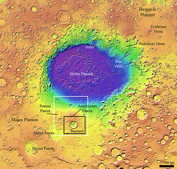
Along the southern rim of Mars’ Hellas basin is a large crater, about 75 miles wide (over 120 kilometers), called Barnard. In a new paper, researchers have mapped it and the surrounding area in high resolution to understand its history and context on the Martian surface.
The research team, led by Planetary Science Institute Senior Scientists Dan Berman and David Crown, found interest in this crater because it is well-preserved but appears to have a long and varied history, having undergone burial, re-excavation and erosion by water and ice, Berman said.
They were also intrigued by its unique positioning – it formed on the flank of Amphitrites Patera, one of several large volcanoes south of Hellas basin. As such, it helps scientists put the surrounding geology in context. (Since it sits atop a volcano, they know the volcano is even older.)
It is also a depression that collects other materials and provides clues to the processes that deposit them, Crown said.
In the process of creating a geologic map of Barnard crater using images taken by the Context Camera (CTX) onboard NASA’s Mars Reconnaissance Orbiter (MRO), the team identified a variety of geologic features of interest in and around Barnard.
Some notable features include what appear to be dried riverbeds, attributed to melting glaciers; lobate debris aprons, which are ice-rich masses that flow downhill; and sinuous ridges, which look like riverbeds in positive relief, that can reach up to 65 feet.
“Sinuous ridges can form when channels are buried, then unburied,” Berman said. “The material that was deposited in the channel can be harder (more resistant to erosion) than the material around it, and it ends up leaving behind these ridges. Some can form beneath glaciers, where material is transported by melting water under the ice mass and their deposits form ridges when the ice recedes. These are called eskers and we believe that is the case here.”
Using digital terrain models, which reveal surface elevations, they found that the crater was filled with debris more than a half-mile thick.
“Basically, the crater formed, and then it was filling in at different episodes,” Berman said. “We know how deep a crater of that size should be, so we take the elevation of the current floor and subtract it from that expected depth to estimate the depth of infilling.”
They also determined that Barnard formed about 3.8 billion years ago, when Mars was still relatively young. (To do so, planetary scientists measure the sizes of craters, with the assumption that older surfaces have accumulated more craters than younger ones.)
There’s also evidence of features shaped by melting ice, such as the channels carved into the crater floor. After topographic analysis, they found that these channels don’t steadily progress downslope.
“Normally, water just flows downhill, but underneath the pressure of a glacier, water can go down and up,” Berman said. “So, I believe at one point there was a glacier in the crater, and there was melting underneath the glacier. This was pretty exciting to find. It has implications for the climatic conditions in the region, because we usually don’t think of the glaciers on Mars as having that wet base like we find on Earth. We traditionally think of Mars as cold and dry unless we’re talking about the most ancient period of Mars, which was warmer and wetter. We’re finding that maybe it wasn’t as cold or dry as we thought.”
This research was supported by NASA Mars Data Analysis Program grant 80NSSC20K0932.