NASA’s Mars Reconnaissance Orbiter HiRISE camera recently snapped its 100,000th image of the Red Planet, and Planetary Science Institute scientists and intern chose the target which later became the milestone image.
Short for High-Resolution Imaging Science Experiment, HiRISE is what the mission relies on to provide high-resolution documentation of everything from impact craters and sand dunes to ice deposits and potential landing sites. Those images, in turn, help improve our understanding of Mars and prepare for NASA’s future human missions there.
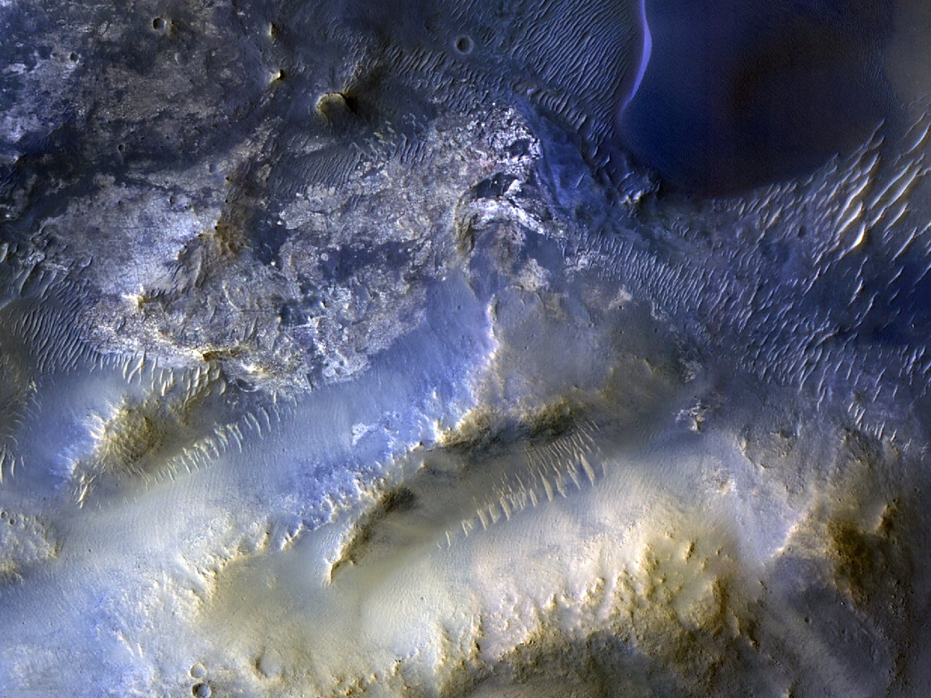
Captured Oct. 7, that milestone image shows mesas and dunes within Syrtis Major, a region about 50 miles (80 kilometers) southeast of Jezero Crater, where NASA’s Perseverance rover is exploring. Scientists are analyzing the image to better understand the source of windblown sand that gets trapped in the region’s landscape, eventually forming dunes.
“HiRISE hasn’t just discovered how different the Martian surface is from Earth. It’s also shown us how that surface changes over time,” said MRO’s project scientist, Leslie Tamppari of NASA’s Jet Propulsion Laboratory in Southern California. “We’ve seen dune fields marching along with the wind and avalanches careening down steep slopes.”
Those dramatic images have inspired the public. The 100,000th image was suggested by a high school student enrolled in the Jefferson County Executive Internship program in Colorado in 2023, one of many public outreach programs the PSI and the HiRISE Team engage in. The target was entered through the HiWish site, where anyone can suggest parts of the planet to study. And at the University of Arizona, which operates the camera, team members make 3D models of HiRISE imagery so that a viewer can enjoy virtual flyover videos.
The student wrote for the initial stereo image: “The objective of this observation is to better resolve dunes and the adjacent underlying geologic units. These dark, eroded units may be the sand source for some regional bedforms.”
“The student intern was working with me to target HiRISE suggestions, to ‘characterize and assess the sand sources, pathways, and sinks across Syrtis Major.’ She entered several dozen targets where most have become acquired images,” said PSI Senior Scientist and intern mentor Matt Chojnacki.
“Rapid data releases, as well as imaging targets suggested by the broader science community and public, has been a hallmark of HiRISE,” said HiRISE’s principal investigator, Shane Byrne of the University of Arizona. “100,000 images just like this one have made Mars more familiar and accessible for everyone.”