R. Aileen Yingst
Senior Scientist
Professional History
Dr. Yingst received her AB in Physics and Astronomy from Dartmouth College and her MSc and PhD in Geological Sciences in 1998 from Brown University. She subsequently served on the faculty of University of Wisconsin, Green Bay, and was the Director of the Wisconsin Space Grant Consortium. She joined the permanent science staff of PSI in 2008. Dr. Yingst served the planetary community as Chair of the Planetary Division of the Geological Society of America (2002-2006) and Chair of the Mars Exploration Program Exploration Group (MEPAG; 2019-2023). She is currently the Principal Investigator for the lunar Heimdall camera system and the Mars Hand Lens Imager (MAHLI) instrument on Mars Science Laboratory (MSL), as well as a Co-Investigator on the combined Mastcam, MAHLI, and MARDI (Mars Descent Imager) science team. She is a Co-Investigator on the Mars 2020 Perseverance rover SHERLOC instrument. She was Associate Principal Investigator on MER. Dr. Yingst supports numerous tactical positions on these mobile missions. She also served as a Participating Scientist on the Dawn at Vesta mission and Associate of the Dawn science team at Ceres.
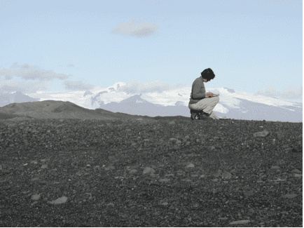
Her Mars rover work focuses on leading the tactical operation of the MAHLI camera and analyzing the resulting grain-scale data for clues to the sedimentary history of Gale crater; and supporting Science Operations and grain-scale analysis on Mars 2020. Dr. Yingst is also actively conducting field work designing and testing rover operations strategies to optimize science return. This work, known as the GeoHeuristic Operational Strategies Tests (GHOST), has been conducted in multiple martian and lunar analogs, including glacial plains in Alaska, volcanic fields in New Mexico, and various sedimentary environments in Utah. Her work includes geologic mapping, a tool used to decipher the geologic processes occurring on planetary surfaces. Her approach combines photogeologic mapping techniques and multispectral data analysis to first characterize and map surface features, and then to compare the morphology of these features with analogous terrestrial examples to better understand geologic context, processes, and stratigraphy. Mapping projects include a global geologic map of the asteroid Ceres (led by Dr. Scott Mest as part of the Dawn at Ceres mission), a global geologic map of the asteroid Vesta, a USGS Special Investigation geologic map of the lunar Planck Quadrangle 29 (in review), a map of the Apollo 17 lunar landing site (led by Dr. Brent Garry) and the lunar Marius Quadrangle 10 (led by Dr. Tracy Gregg).

